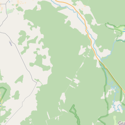
Deal ID: 1148829
Transaction object type | Transaction object type: The land |
|---|---|
Object | Object: Land |
Property cadastral number | |
Administrative area | Administrative area: Daukstu pag., Gulbenes nov. |
Transaction date | Transaction date: |
Administrative area | |
|---|---|
Address ID | Address ID: 100011340 |
Companies registered at the address | |
Departments registered at the address | |
Institutions registered at the address | |
Real estate registered at the address | |
Transactions with real estate at the address |
|
{"7201060110":{"name":"<div class='color_dot' style='background-color: #00ffff'><\/div><span>Measured land unit<\/span>","featureColor":"#00ffff","features":{"type":"FeatureCollection","features":[{"type":"Feature","geometry":{"type":"Polygon","coordinates":[[[26.748248402,57.093021607],[26.748358101,57.092896106],[26.748507641,57.092732505],[26.750159136,57.092615048],[26.751524947,57.093081216],[26.750018542,57.093501723],[26.748248402,57.093021607]]]},"crs":{"type":"name","properties":{"name":"urn:ogc:def:crs:EPSG:3059"}},"properties":{"style":{"color":"#00ffff","dashArray":"0","weight":1},"name":"Land","object_type":"Parcel","parcel_code":"50480040327","code":null,"surveyor":null,"address":"","ownership":"<span>Owner - Legal entity<br><\/span>","pro_cadastre_nr":"50480040231"}},{"type":"Feature","geometry":{"type":"Polygon","coordinates":[[[26.755551009,57.096903285],[26.755609319,57.096872433],[26.758923905,57.095118474],[26.761018623,57.096316797],[26.756920858,57.098417048],[26.756446108,57.097670396],[26.755917078,57.097152476],[26.755870712,57.097120907],[26.755551009,57.096903285]]]},"crs":{"type":"name","properties":{"name":"urn:ogc:def:crs:EPSG:3059"}},"properties":{"style":{"color":"#00ffff","dashArray":"0","weight":1},"name":"Land","object_type":"Parcel","parcel_code":"50480040231","code":null,"surveyor":null,"address":"","ownership":"<span>Owner - Legal entity<br><\/span>","pro_cadastre_nr":"50480040231"}},{"type":"Feature","geometry":{"type":"Polygon","coordinates":[[[26.763499648,57.097187882],[26.765463812,57.096239107],[26.766099083,57.096433721],[26.766120235,57.096409347],[26.768066252,57.096909541],[26.768038077,57.096942016],[26.764633761,57.098519597],[26.764049903,57.097798676],[26.763499648,57.097187882]]]},"crs":{"type":"name","properties":{"name":"urn:ogc:def:crs:EPSG:3059"}},"properties":{"style":{"color":"#00ffff","dashArray":"0","weight":1},"name":"Land","object_type":"Parcel","parcel_code":"50480040132","code":null,"surveyor":null,"address":"","ownership":"<span>Owner - Legal entity<br><\/span>","pro_cadastre_nr":"50480040231"}}]}},"7114100000":{"name":"<div class='color_dot' style='background-color: #b40000'><\/div><span>Burdened access road servitude area<\/span>","featureColor":"#b40000","features":{"type":"FeatureCollection","features":[{"type":"Feature","geometry":{"type":"Polygon","coordinates":[[[26.750018542,57.093501723],[26.748248402,57.093021607],[26.748259042,57.093009447],[26.75004573,57.09349407],[26.750018542,57.093501723]]]},"crs":{"type":"name","properties":{"name":"urn:ogc:def:crs:EPSG:3059"}},"properties":{"style":{"color":"#b40000","dashArray":"4,2,1,2","weight":1},"name":"Burdened access road servitude area","object_type":"WayRestriction","parcel_code":"50480040327","code":"7315030100002","surveyor":null,"address":"","ownership":"<span>Owner - Legal entity<br><\/span>","pro_cadastre_nr":"50480040231"}}]}}}
[]
https://tile.openstreetmap.org/{z}/{x}/{y}.png|© OpenStreetMap contributors|minZoom: 7|maxZoom: 19
|
Data source and license: Open data of the real estate market database, Open data of the cadastral information system, open data license: Creative Commons Attribution, OpenStreetMap

