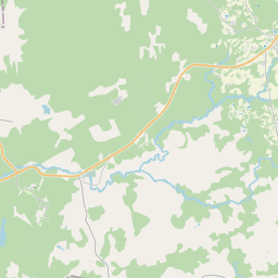
Deal ID: 1111603
Transaction object type | Transaction object type: The land |
|---|---|
Object | Object: Land |
Property cadastral number | |
Administrative area | Administrative area: Kalncempju pag., Alūksnes nov. |
Actual address | Actual address : Beļavas pag., Gulbenes nov. |
Transaction date | Transaction date: |
Administrative area | |
|---|---|
Address ID | Address ID: 100010283 |
Companies registered at the address | |
Departments registered at the address | |
Institutions registered at the address | |
Real estate registered at the address | |
Transactions with real estate at the address |
|
{"7201060210":{"name":"<div class='color_dot' style='background-color: #00ffff'><\/div><span>Specified land unit<\/span>","featureColor":"#00ffff","features":{"type":"FeatureCollection","features":[{"type":"Feature","geometry":{"type":"Polygon","coordinates":[[[26.810643779,57.325195429],[26.811303318,57.325150099],[26.811523862,57.325170063],[26.812336498,57.325245269],[26.813661182,57.325383727],[26.813702726,57.325362305],[26.814027148,57.325194995],[26.814290442,57.32507984],[26.814373689,57.325087306],[26.817332518,57.325352583],[26.816756342,57.32559347],[26.814292989,57.327023186],[26.814052061,57.327420911],[26.813630402,57.329032493],[26.813621697,57.329160913],[26.813433309,57.329273832],[26.812399675,57.329856258],[26.812116856,57.329685017],[26.810995188,57.32904653],[26.81110297,57.326287277],[26.810643779,57.325195429]]]},"crs":{"type":"name","properties":{"name":"urn:ogc:def:crs:EPSG:3059"}},"properties":{"style":{"color":"#00ffff","dashArray":"8,12","weight":1},"name":"Land","object_type":"Parcel","parcel_code":"36640040085","code":null,"surveyor":null,"address":"","ownership":"<span>Owner - Legal entity<br><\/span>","pro_cadastre_nr":"36640040084"}},{"type":"Feature","geometry":{"type":"Polygon","coordinates":[[[26.82818504,57.315632529],[26.828483014,57.315680434],[26.829071194,57.315549182],[26.829648774,57.315436322],[26.830040408,57.315243916],[26.830532529,57.315081278],[26.830788206,57.31494317],[26.830982427,57.314946346],[26.831274524,57.314935588],[26.831752604,57.31470004],[26.832019609,57.31457972],[26.832258366,57.314515419],[26.832505432,57.314464761],[26.832729184,57.314409892],[26.832840473,57.314461687],[26.832766106,57.314698398],[26.832866583,57.314707045],[26.833070148,57.314629424],[26.833323068,57.314452213],[26.833517771,57.314328784],[26.833758936,57.314262573],[26.833976616,57.314196622],[26.833997387,57.314092761],[26.834017816,57.314080652],[26.834410804,57.314004223],[26.83466373,57.313932263],[26.83482483,57.313880502],[26.834776228,57.31376963],[26.834384147,57.313519816],[26.834392526,57.313505472],[26.834447347,57.31349026],[26.835351844,57.31372068],[26.837509779,57.314132308],[26.838125551,57.314363024],[26.83998793,57.314447734],[26.840252363,57.314459762],[26.840392553,57.314496553],[26.840544312,57.314545073],[26.840557932,57.314551317],[26.840450551,57.314826221],[26.840374427,57.315023602],[26.840314334,57.3151599],[26.840268761,57.31526889],[26.840227662,57.315382263],[26.840148693,57.315542813],[26.839895119,57.315647505],[26.839211499,57.31591167],[26.83861884,57.31614321],[26.83851107,57.316307565],[26.838332031,57.316571125],[26.838227885,57.316728657],[26.838085918,57.316934272],[26.83795051,57.317117253],[26.837763125,57.317412718],[26.837812555,57.317569029],[26.837832659,57.317640386],[26.836386768,57.317701247],[26.834326319,57.31850833],[26.833470784,57.318637166],[26.832825117,57.31874134],[26.832179917,57.318751689],[26.831881773,57.318799973],[26.831680656,57.318896554],[26.831303599,57.319150992],[26.831243804,57.319103824],[26.830568795,57.319343533],[26.830521537,57.319340778],[26.829599789,57.319287092],[26.829896682,57.318812236],[26.830134653,57.318475524],[26.830136238,57.318307987],[26.829642201,57.318002753],[26.829012189,57.317085547],[26.828589907,57.316351325],[26.828326207,57.315856793],[26.82818504,57.315632529]]]},"crs":{"type":"name","properties":{"name":"urn:ogc:def:crs:EPSG:3059"}},"properties":{"style":{"color":"#00ffff","dashArray":"8,12","weight":1},"name":"Land","object_type":"Parcel","parcel_code":"36640040084","code":null,"surveyor":null,"address":"","ownership":"<span>Owner - Legal entity<br><\/span>","pro_cadastre_nr":"36640040084"}}]}},"7114100000":{"name":"<div class='color_dot' style='background-color: #b40000'><\/div><span>Burdened access road servitude area<\/span>","featureColor":"#b40000","features":{"type":"FeatureCollection","features":[{"type":"Feature","geometry":{"type":"Polygon","coordinates":[[[26.831013172,57.318783774],[26.832136515,57.318123211],[26.832935283,57.317411568],[26.834023407,57.316399268],[26.836119346,57.315644603],[26.836277161,57.315517607],[26.836381376,57.315322318],[26.836383982,57.314921618],[26.836716537,57.314329577],[26.837065589,57.314049518],[26.837110742,57.314061468],[26.836752477,57.314336846],[26.836423182,57.314922037],[26.836431174,57.315322093],[26.836318485,57.315532645],[26.836160669,57.315659633],[26.834067248,57.31641204],[26.832988147,57.317420721],[26.832175648,57.31813999],[26.83105334,57.318795003],[26.830527451,57.319337975],[26.830472061,57.319334899],[26.831013172,57.318783774]]]},"crs":{"type":"name","properties":{"name":"urn:ogc:def:crs:EPSG:3059"}},"properties":{"style":{"color":"#b40000","dashArray":"4,2,1,2","weight":1},"name":"Burdened access road servitude area","object_type":"WayRestriction","parcel_code":"36640040084","code":"7315030100002","surveyor":null,"address":"","ownership":"<span>Owner - Legal entity<br><\/span>","pro_cadastre_nr":"36640040084"}}]}}}
[]
https://tile.openstreetmap.org/{z}/{x}/{y}.png|© OpenStreetMap contributors|minZoom: 7|maxZoom: 19
|
Data source and license: Open data of the real estate market database, Open data of the cadastral information system, open data license: Creative Commons Attribution, OpenStreetMap

