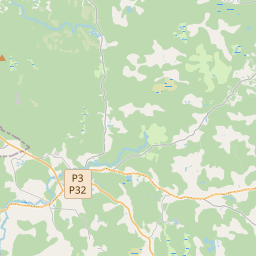
Deal ID: 1103623
Transaction object type | Transaction object type: The land |
|---|---|
Object | Object: Land |
Property cadastral number | |
Address record | Address record: "Jaundzintari", Ģikši, Amatas pag., Cēsu nov., LV-4141 |
Transaction date | Transaction date: |
Address | |
|---|---|
Address ID | Address ID: 105822686 |
Companies registered at the address | Companies registered at the address: 0 |
Departments registered at the address | Departments registered at the address: 0 |
Institutions registered at the address | Institutions registered at the address: 0 |
Real estate registered at the address | Real estate registered at the address: 0 |
Transactions with real estate at the address |
| Cadastral object type | Cadastre designation of the cadastral object | Person's property right status | Person status | Land Register |
|---|---|---|---|---|
| Cadastral object type: Real Estate | 42420050112 | Person's property right status: Owner | Person status: Natural person | Land Register |
05.02.2025. State land service data
|
{"7201060210":{"name":"<div class='color_dot' style='background-color: #00ffff'><\/div><span>Specified land unit<\/span>","featureColor":"#00ffff","features":{"type":"FeatureCollection","features":[{"type":"Feature","geometry":{"type":"Polygon","coordinates":[[[25.328692833,57.174059953],[25.328707618,57.173901324],[25.328747097,57.173467974],[25.330230006,57.172965661],[25.330683947,57.174161826],[25.33122358,57.175165078],[25.329602064,57.174687639],[25.328806053,57.174294564],[25.328692833,57.174059953]]]},"crs":{"type":"name","properties":{"name":"urn:ogc:def:crs:EPSG:3059"}},"properties":{"style":{"color":"#00ffff","dashArray":"8,12","weight":1},"name":"Land","object_type":"Parcel","parcel_code":"42420050201","code":null,"surveyor":null,"address":"\"Jaundzintari\", \u0122ik\u0161i, Amatas pag., C\u0113su nov., LV-4141","ownership":"<span>Owner - Natural person<br><\/span>","pro_cadastre_nr":"42420050112"}},{"type":"Feature","geometry":{"type":"Polygon","coordinates":[[[25.314975717,57.178963553],[25.315032816,57.178859052],[25.315055979,57.178495435],[25.315093384,57.178452655],[25.315142648,57.17839632],[25.315192554,57.178277951],[25.315335421,57.178237166],[25.315275751,57.178080658],[25.31565232,57.178017784],[25.315754568,57.177849759],[25.316243867,57.177913376],[25.316440473,57.177862215],[25.316745606,57.177819726],[25.317084359,57.177708146],[25.317078771,57.177551071],[25.317331209,57.177548422],[25.317362732,57.177420416],[25.317795477,57.177415873],[25.317988583,57.177266532],[25.317914706,57.177218209],[25.318309303,57.177155137],[25.318307904,57.177115864],[25.318106412,57.177029594],[25.318171551,57.176832497],[25.318043587,57.176784733],[25.318092782,57.176646731],[25.318399301,57.176643511],[25.318443267,57.176358241],[25.318717007,57.176167613],[25.320897868,57.17569591],[25.323156794,57.17554021],[25.323283848,57.175531449],[25.324507207,57.174848987],[25.324702615,57.17506702],[25.324819865,57.175225783],[25.324883769,57.175338273],[25.324975832,57.175546589],[25.32513957,57.175887573],[25.325253751,57.176058891],[25.325482439,57.176346352],[25.325775277,57.176865647],[25.326063736,57.177444409],[25.326104769,57.177541634],[25.323844326,57.178064147],[25.320632275,57.178419332],[25.318613938,57.178670143],[25.31525694,57.178945756],[25.314975717,57.178963553]]]},"crs":{"type":"name","properties":{"name":"urn:ogc:def:crs:EPSG:3059"}},"properties":{"style":{"color":"#00ffff","dashArray":"8,12","weight":1},"name":"Land","object_type":"Parcel","parcel_code":"42420050113","code":null,"surveyor":null,"address":"","ownership":"<span>Owner - Natural person<br><\/span>","pro_cadastre_nr":"42420050112"}},{"type":"Feature","geometry":{"type":"Polygon","coordinates":[[[25.324593066,57.17434067],[25.325548626,57.174391593],[25.325686098,57.174392091],[25.325784403,57.174369104],[25.325992084,57.174293212],[25.326063216,57.174270773],[25.326300728,57.174185483],[25.326718502,57.174242897],[25.329602064,57.174687639],[25.33122358,57.175165078],[25.332650707,57.175145144],[25.333992984,57.175619852],[25.332727276,57.175920407],[25.330006278,57.17658406],[25.329908314,57.175736124],[25.329937837,57.175515913],[25.329943192,57.175479857],[25.329590864,57.175538843],[25.329168114,57.175595375],[25.328718805,57.175684396],[25.328580073,57.175720364],[25.328030236,57.175901537],[25.327146854,57.176217072],[25.32718435,57.176250663],[25.328051573,57.177040556],[25.326446323,57.177407493],[25.326427095,57.177411937],[25.326398144,57.177355535],[25.326125466,57.176812013],[25.325960307,57.17651117],[25.325825542,57.176280216],[25.325591835,57.175985684],[25.325488266,57.175830354],[25.325359496,57.175555089],[25.325235135,57.175286471],[25.325163497,57.175160335],[25.325034913,57.174986257],[25.32485007,57.174783395],[25.324789098,57.17470151],[25.324727178,57.174613902],[25.324665675,57.174457058],[25.324593066,57.17434067]]]},"crs":{"type":"name","properties":{"name":"urn:ogc:def:crs:EPSG:3059"}},"properties":{"style":{"color":"#00ffff","dashArray":"8,12","weight":1},"name":"Land","object_type":"Parcel","parcel_code":"42420050112","code":null,"surveyor":null,"address":"\"Renc\u0113na S\u012b\u013ci\", Amatas pag., C\u0113su nov., LV-4141","ownership":"<span>Owner - Natural person<br><\/span>","pro_cadastre_nr":"42420050112"}}]}},"7114100000":{"name":"<div class='color_dot' style='background-color: #b40000'><\/div><span>Burdened access road servitude area<\/span>","featureColor":"#b40000","features":{"type":"FeatureCollection","features":[{"type":"Feature","geometry":{"type":"Polygon","coordinates":[[[25.32871129,57.173888411],[25.328716503,57.173831791],[25.328984402,57.17388321],[25.329208682,57.173926726],[25.329424938,57.17400887],[25.3296658,57.174100455],[25.329898538,57.174190131],[25.330257635,57.174185957],[25.33048747,57.174175444],[25.330680877,57.17416202],[25.330708438,57.174214591],[25.330498836,57.174228924],[25.330258346,57.174240286],[25.329867675,57.174244058],[25.32945235,57.174084541],[25.329164,57.1739754],[25.328950066,57.173933975],[25.32871129,57.173888411]]]},"crs":{"type":"name","properties":{"name":"urn:ogc:def:crs:EPSG:3059"}},"properties":{"style":{"color":"#b40000","dashArray":"4,2,1,2","weight":1},"name":"Burdened access road servitude area","object_type":"WayRestriction","parcel_code":"42420050201","code":"7315030100002","surveyor":null,"address":"\"Jaundzintari\", \u0122ik\u0161i, Amatas pag., C\u0113su nov., LV-4141","ownership":"<span>Owner - Natural person<br><\/span>","pro_cadastre_nr":"42420050112"}},{"type":"Feature","geometry":{"type":"Polygon","coordinates":[[[25.327146854,57.176217072],[25.327119597,57.176194558],[25.328002979,57.175879023],[25.328554335,57.175697322],[25.328697438,57.175660077],[25.32915111,57.175570058],[25.329579007,57.17551268],[25.32992857,57.175454101],[25.329943192,57.175479857],[25.329590864,57.175538843],[25.329168114,57.175595375],[25.328718805,57.175684396],[25.328580073,57.175720364],[25.328030236,57.175901537],[25.327146854,57.176217072]]]},"crs":{"type":"name","properties":{"name":"urn:ogc:def:crs:EPSG:3059"}},"properties":{"style":{"color":"#b40000","dashArray":"4,2,1,2","weight":1},"name":"Burdened access road servitude area","object_type":"WayRestriction","parcel_code":"42420050112","code":"7315030100005","surveyor":null,"address":"\"Renc\u0113na S\u012b\u013ci\", Amatas pag., C\u0113su nov., LV-4141","ownership":"<span>Owner - Natural person<br><\/span>","pro_cadastre_nr":"42420050112"}}]}},"5201011310":{"name":"<div class='color_dot' style='background-color: #960096'><\/div><span>Vectorized building<\/span>","featureColor":"#960096","features":{"type":"FeatureCollection","features":[{"type":"Feature","geometry":{"type":"Polygon","coordinates":[[[25.325912623,57.176053595],[25.325993346,57.176036975],[25.326025586,57.176083172],[25.325944863,57.176099792],[25.325912623,57.176053595]]]},"crs":{"type":"name","properties":{"name":"urn:ogc:def:crs:EPSG:3059"}},"properties":{"style":{"color":"#960096","dashArray":"0","weight":2},"name":"Building","object_type":"Building","parcel_code":"42420050112","code":"42420050112003","surveyor":null,"address":"\"Renc\u0113na S\u012b\u013ci\", Amatas pag., C\u0113su nov., LV-4141","ownership":null,"pro_cadastre_nr":null}},{"type":"Feature","geometry":{"type":"Polygon","coordinates":[[[25.326146517,57.17585029],[25.326252647,57.175826313],[25.326418438,57.17604277],[25.326312323,57.176066747],[25.326146517,57.17585029]]]},"crs":{"type":"name","properties":{"name":"urn:ogc:def:crs:EPSG:3059"}},"properties":{"style":{"color":"#960096","dashArray":"0","weight":2},"name":"Building","object_type":"Building","parcel_code":"42420050112","code":"42420050112002","surveyor":null,"address":"\"Renc\u0113na S\u012b\u013ci\", Amatas pag., C\u0113su nov., LV-4141","ownership":null,"pro_cadastre_nr":null}},{"type":"Feature","geometry":{"type":"Polygon","coordinates":[[[25.325498631,57.175831098],[25.325617071,57.175809039],[25.325698212,57.175937609],[25.325579787,57.175959658],[25.325498631,57.175831098]]]},"crs":{"type":"name","properties":{"name":"urn:ogc:def:crs:EPSG:3059"}},"properties":{"style":{"color":"#960096","dashArray":"0","weight":2},"name":"Building","object_type":"Building","parcel_code":"42420050112","code":"42420050112001","surveyor":null,"address":"\"Renc\u0113na S\u012b\u013ci\", Amatas pag., C\u0113su nov., LV-4141","ownership":null,"pro_cadastre_nr":null}}]}}}
[]
https://tile.openstreetmap.org/{z}/{x}/{y}.png|© OpenStreetMap contributors|minZoom: 7|maxZoom: 19
|
Data source and license: Open data of the real estate market database, Open data of the cadastral information system, open data license: Creative Commons Attribution, OpenStreetMap


